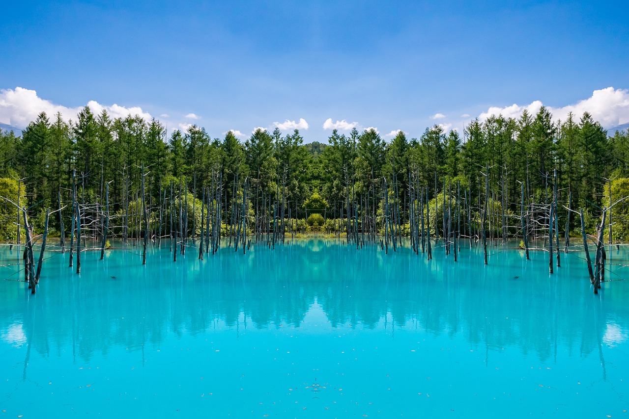
青い池の水が青く見えるのは水中で出来た粒子と光の衝突?!
釧路湿原国立公園は東京ドーム5000個以上?!
道北エリア(美瑛、富良野、稚内など)
青い池 Shirogane Blue Pond
- Q正式名称は?
What is the official name? - A
青い池の正式名称は「白金青い池」です。
- Qなぜ青いの?
Why blue? - A
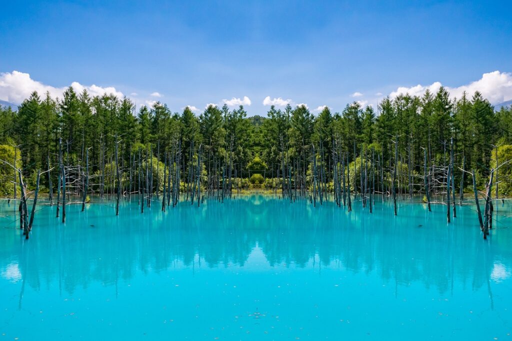
白金温泉付近で合流する支流や「白ひげの滝」に含まれる硫黄などの温泉成分をはじめ、アルミニウムなどを含んだ水と美瑛川の水です。その2つの水が混ざると目に見えない「コロイド」が生成されます。
太陽の光と水中のコロイド粒子が衝突し、いろんな方向に光が散乱します。波長の短い青い光が散乱されやすいため、その光がわたしたちの目に届き、青く見えると言われています。また池の底にある白い土壌が光を反射して、青さを引き立てているという一説もあります。This is the water of the Biei River and the water that contains sulfur and other hot spring elements such as sulfur contained in the tributaries that merge near Shirogane Onsen and “Shirohige no Taki” waterfalls, as well as aluminum. When these two waters mix, invisible “colloids” are formed.
When sunlight collides with colloidal particles in the water, light is scattered in various directions. It is said that blue light, which has a shorter wavelength, is scattered more easily, so that light reaches our eyes and makes us see blue. Another theory is that the white soil at the bottom of the pond reflects the light, enhancing the blue color.
- Qベストシーズンは?
When is the best season? - A
この青い池が一番美しく見える時期は5月から6月と言われています。 その他の時期も美しいことは間違いありませんが、水酸化アルミニウムを含まない水が流れ込んでしまうため、池の青みが十分ではないかもしれません。 もちろん、季節によって別の美しさを楽しめます。
It is said that the most beautiful time of year for this blue pond is from May to June. Other times of the year are no doubt beautiful as well, but the ponds may not be blue enough because water without aluminum hydroxide flows into them. Of course, different seasons offer different beauty.
- Q訪れる際の注意点は?
Any precautions? - A
池までの道のりは舗装されていない道も含まれるため、歩きやすい靴を選ぶようにしましょう。
太陽光が当たらない雨の日は避けましょう。 曇りの日や雨が降った次の日も、はっきりと青さが出なくなってしまうので注意が必要です。 風が出てしまうと、池の水が波を打ってしまうため、その青さがわかりにくい場合があります。
The path to the pond includes unpaved roads, so choose shoes that are comfortable to walk in.
Avoid rainy days when there is no sunlight. Be careful on cloudy days or the day after it rains, as well, as the blue color will not be clearly visible. If the wind picks up, the water in the pond will wave and its blueness may be difficult to see.
詳細
 青い池  Shirogane Blue Pond

住所:〒071-0235 北海道上川郡美瑛町白金
アクセス:JR美瑛駅より車で約20分 道北バスで約20分
電話番号:0166924321
公式サイト:https://www.biei-hokkaido.jp/ja/shirogane-blue-pond
マイルドセブンの丘 Mild Seven Hill
- Qなぜマイルドセブンの丘というの?
Why is it called Mild Seven Hills? - A
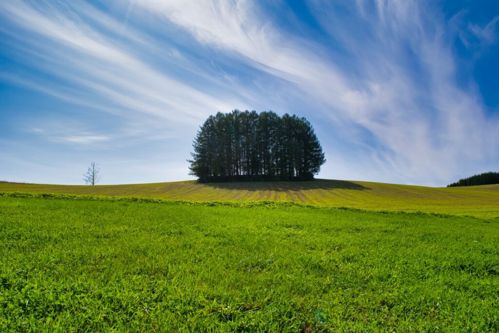
昭和53年(1978)にタバコブランドマイルドセブンのCMが撮影されたことがきっかけです。
The name was inspired by a commercial filmed for the cigarette brand Mild Seven in 1978.
- Qこの丘では遊べるの?
Can we play on this hill? - A
残念ながら遊べません。この場所は訪れる方に楽しんでいただけるよう、農家さんのご好意で私有地を少し開放してくださっています。
Unfortunately, it is not playable. The farmer has kindly opened up some of his private land for visitors to enjoy.
- Q訪れる際の注意点は?
Any precautions? - A
鑑賞エリア以外の農地には入ってはいけません。農家の方々が生活の場として一生懸命に農作物を管理しています。農家さんの悲しむような行為は絶対にしないように看板も置いてあります。
Do not enter farmland outside of the viewing area. Farmers work hard to manage their crops as a place to live. Signs are also placed to ensure that you do not do anything that will make the farmers sad.
詳細
 マイルドセブンの丘  Mild Seven Hill

住所:〒071-0216 北海道上川郡美瑛町大村
アクセス:	JR美瑛駅から徒歩で60分 / JR美瑛駅から車で10分
電話番号:0166-92-4378
公式サイト:私有地のためなし
一般社団法人 美瑛町観光協会サイト:https://www.biei-hokkaido.jp/ja/9388
ファーム富田 Farm Tomita
- Qラベンダーの見頃はいつ?
When is the best time to see lavender? - A
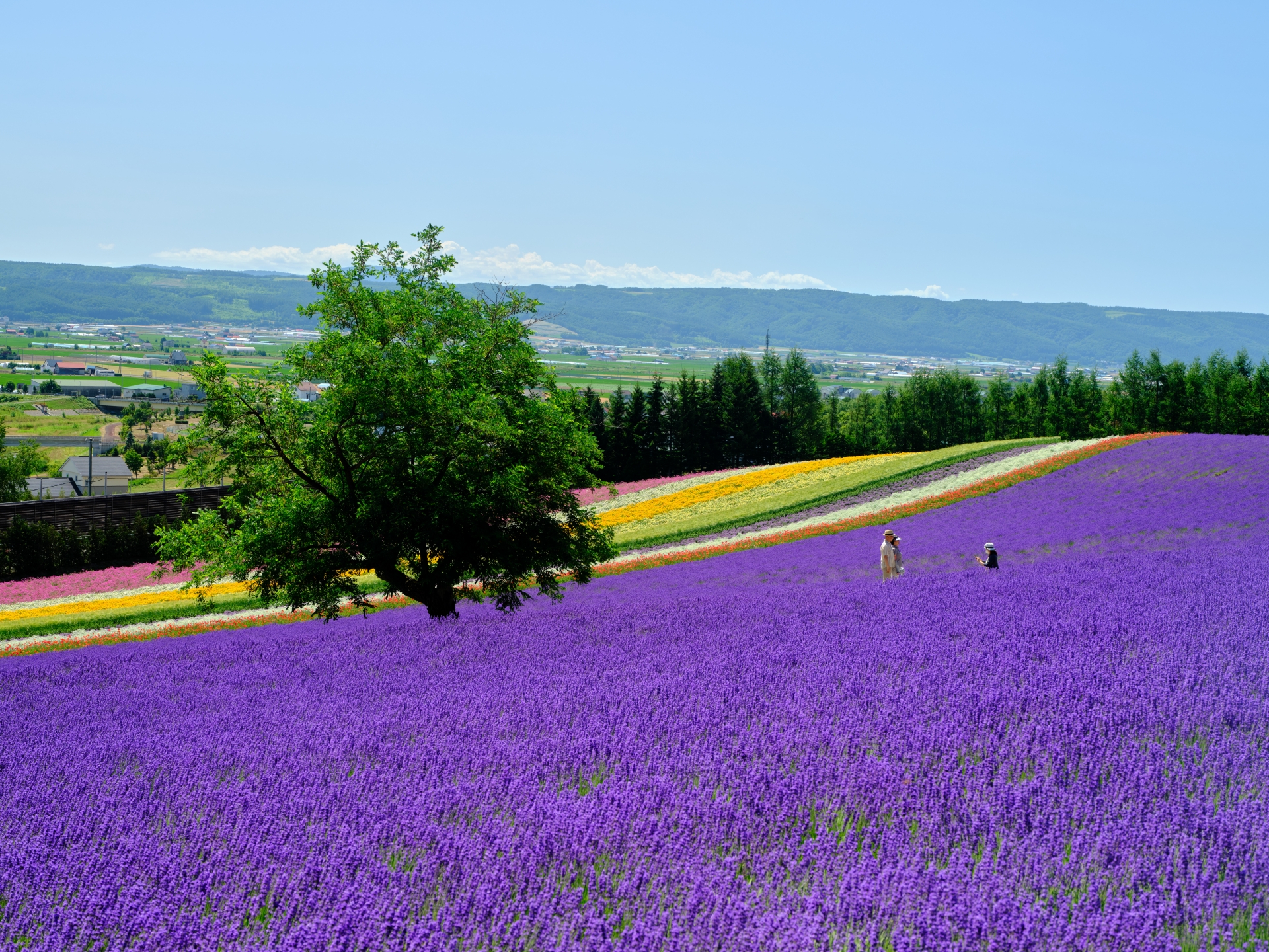
ラベンダーは例年6月下旬ごろより早咲の品種が色づき始め、7月中旬~下旬ごろに見頃のピークを迎えます。 その後順々に刈取りを行っていき、8月上旬~中旬ごろにすべての刈取りが終了します。
Early-blooming lavender varieties usually begin to change color in late June and reach their peak in mid to late July. After that, the lavenders are harvested one by one until all the harvesting is completed in early to mid-August.
- Q上記以外の季節はラベンダーは見られないの?
Can’t we see lavender in seasons other than the above? - A
畑にラベンダーが咲いていない夏以外の季節にも、ラベンダーを楽しんでいただける温室があります。観賞用として人気のある品種のラベンダー「濃紫早咲」のほか、色とりどりの花々や観葉植物も育てられています。
There is a greenhouse where visitors can enjoy lavender in the non-summer season when the fields are not in bloom. In addition to the popular ornamental variety of lavender, “Kuromuri-Hayasaka”, a variety of colorful flowers and ornamental plants are also grown.
園内の花々の状況は公式ページで確認できます▼
You can check the status of flowers in the park on the official page
暑い一日になりそうです | ファーム日誌 | 花畑の紹介 | 北海道のラベンダー畑「ファーム富田」オフィシャルサイト暑い一日になりそうです
- Q訪れる際の注意点は?
Any precautions? - A
園内への飲食物のお持ち込みは禁止です。三脚も禁止です。美しい景色を一緒に楽しみたい気持ちは分かりますが、ペットの入園も禁止です。
通路を除き、畑の中への立ち入りは禁止です。また園内の花や木に実る果樹などは決して摘み取ったり持ち帰らないように気をつけましょう。
No food or beverages are allowed in the park. Tripods are also prohibited. Pets are also not allowed in the park, although we understand that you want to enjoy the beautiful scenery with them.
No one is allowed to enter the fields, except in the pathways. Also, please be careful not to pick or take home any of the flowers or fruit trees in the park.
詳細
 ファーム富田  Farm Tomita

住所:〒071-0704 北海道空知郡中富良野町基線北15号
アクセス:旭川空港より国道237号経由 約45分 / JR富良野線「ラベンダー畑駅」(ファーム富田から徒歩約7分)
電話番号:0167393939
公式サイト:http://www.farm-tomita.co.jp/
道央エリア(小樽、札幌、登別など)
小樽運河 Otaru Canal
- Qどのようにして造られたの?
How was it built? - A
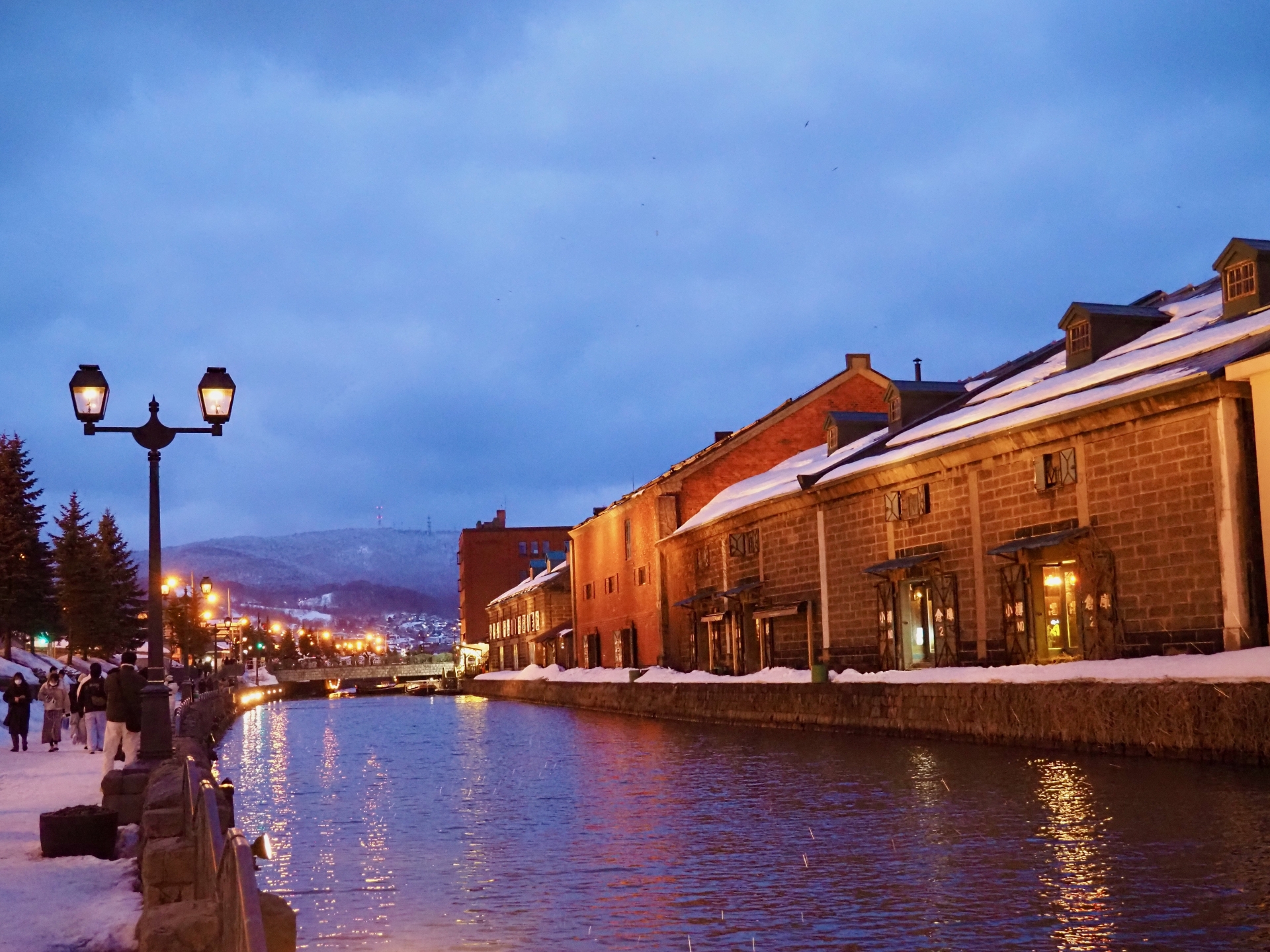
元々は1923(大正12)年に、ハシケとよばれる小型船が、港に停泊している本船から貨物を運び往来するために造られたもの。
運河としての役割を終え、1986(昭和61)年に一部を埋め立て、散策路や街園が整備された現在も北側(通称:北運河)は昔のままの河幅40mが残されています。
It was originally built in 1923 for small boats called “Hashike” to carry cargo to and from the main vessel anchored in the harbor.
After its role as a canal was completed, a portion of the canal was reclaimed in 1986, and the north side (commonly called “North Canal”) remains 40 m wide as it was in the past, even after the construction of walking paths and a town park.
- Qガス灯の点灯の時間帯は?
When are the gas lights on? - A
・小樽運河散策路 日没~24:00(6月~8月は18:00~24:00)
・北運河散策路 光センサーで点灯・消灯(6月~8月は18:00~翌朝4:00)
・運河プラザ前ガス灯 日没~24:00
※小樽雪あかりの路期間中は、ガス灯の点灯は15時からです。・運河倉庫群ライトアップ 日没~22:30
Otaru Canal Walkway: Sunset to 24:00 (18:00 to 24:00 from June to August)
North Canal Walkway Lights are turned on and off by light sensors (18:00 to 4:00 the next morning from June to August)
Gas light in front of Unga Plaza: Sunset – 24:00
During the Otaru Snow Light Path, gas lights are turned on from 15:00.During the Otaru Snow Light Path, gas lights are turned on from 3:00 p.m.
詳細
 小樽運河  Otaru Canal

住所:〒047-0007 北海道小樽市港町
アクセス:JR小樽駅から徒歩8分
電話番号:0134324111
公式サイト:https://www.city.otaru.lg.jp
藻岩山 Mt. Moiwa
- Qごはん食べる場所はあるの?
Is there a place to eat? - A
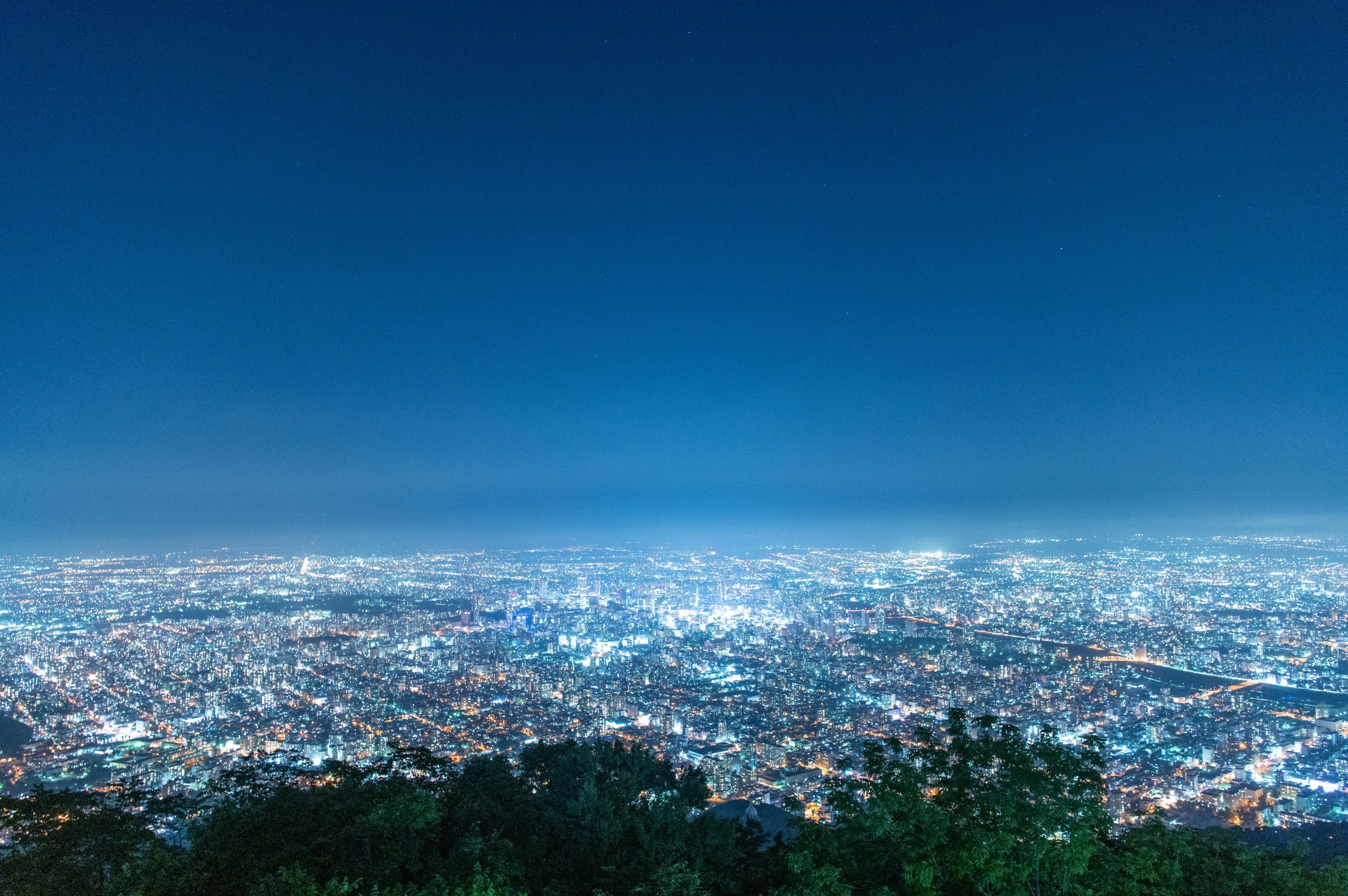
札幌で1番高い場所にある展望レストラン「ザ・ジュエルズ」。ガラス張りの店内はまるで空の上で食事をしているような気分になれます。地元北海道の食材を使ったメニューもあり、旬にこだわった料理を堪能できます。
The Jewels is an observatory restaurant located at the highest point in Sapporo. The glass-walled interior of the restaurant makes you feel as if you are dining in the sky. The menu includes dishes using local Hokkaido ingredients, and you can enjoy dishes that focus on the season.
- Q訪れる際の注意点は?
Any precautions? - A
藻岩山観光自動車道夏期冬期間通行止めになるため注意が必要です。
※営業期間は積雪等の状況により変更となります。Please note that Mt. Moiwa Tourist Highway is closed during summer and winter.
*Opening period is subject to change depending on snowfall and other conditions.
詳細
 藻岩山  Mt.Moiwai

住所:〒005-0041 北海道札幌市南区藻岩山
アクセス:	①市電 <ロープウェイ入口>から無料シャトルバス ②もいわ山ロープウェイ乗り場「もいわ山麓駅」に無料駐車場あり
電話番号:0115618177
公式サイト:https://mt-moiwa.jp/
神威岬 Cape Kamui
- Q現在でも女人禁制の門は女性は通れないの?
Are women currently not allowed to pass through the women’s gate? - A
現在は通れます。1855年に解除されました。
The gate is now passable. it was lifted in 1855.
- Q女人禁制の門の歴史は?
When is the best time to see lavender? - A
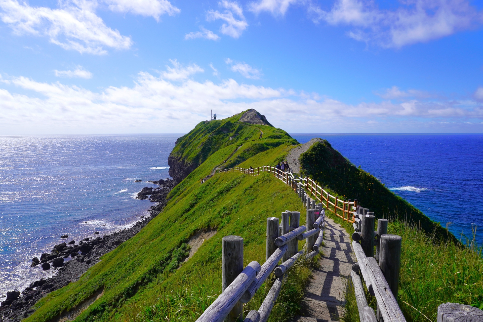
アイヌ民族の娘チャランカの悲恋の伝説があります。源義経に強く思いを寄せる首長の娘チャレンカ。しかし義経は大陸へ向かって旅立ってしまう。チャレンカはその後を追い、神威岬までたどり着くも義経の船は沖の彼方へ。悲しみにくれたチャレンカは、「和人の船、婦女を乗せてここを過ぐればすなわち覆沈せん」と恨みの言葉を残し海に身を投げてしまった。悲しみと恨みを抱いたチャレンカの身体は神威岩と化し、以来、その周辺に女性を乗せた船が近づくと必ず転覆したことから、神威岬は女人禁制の地に。この決まりは明治時代初期まで続くこととなった。
There is a legend of a tragic love story of Chalenka, a daughter of the Ainu tribe. Chalenka is the daughter of a chief who has strong feelings for Minamoto no Yoshitsune. However, Yoshitsune leaves for the continent. Chalenka followed her and reached Cape Kamui, but Yoshitsune’s ship went out to sea. Saddened, Chalenka threw herself into the sea, leaving behind words of resentment: “If a ship of the Japanese people passes over here with a woman on board, it will be overturned and sink. Since then, whenever a ship carrying a woman approached the area, it would capsize, making Cape Kamui a no-go area for women. This rule continued until the early Meiji period (1868-1912).
- Q神威岬は先端まで行くのにどのくらい時間がかかるの?
Can’t we see lavender in seasons other than the above? - A
遊歩道の先端まで往復40分程。
It takes about 40 minutes round trip to the tip of the boardwalk.
- Q訪れる際の注意点は?
Any precautions? - A
神威岬入り口にはゲートがあり、時期により開閉時間が変わります。
4月 開園時間 8:00~17:30(入園時間 8:00~16:30)
5月 開園時間 8:00~18:00(入園時間 8:00~17:00)
6月 開園時間 8:00~18:30(入園時間 8:00~17:30)
7月 開園時間 8:00~18:00(入園時間 8:00~17:00)
8月~10月 開園時間 8:00~17:30(入園時間 8:00~16:30)
11月 開園時間 8:00~16:30(入園時間 8:00~15:30)
12月~3月 開園時間 10:00~15:00(入園時間 10:00~14:00)※女人禁制の門及び入口ゲートの開閉時間は、天候(雨・風)の状況に
より変更となる場合がありますのでご了承ください。There is a gate at the entrance to Cape Kamui, and the opening and closing times vary depending on the time of year.
April: Open 8:00-17:30 (Entrance 8:00-16:30)
May Opening hours: 8:00 – 18:00 (Entrance time: 8:00 – 17:00)
June: Open 8:00-18:30 (Entrance 8:00-17:30)
July: Open 8:00-18:00 (Entrance 8:00-17:00)
August – October Opening hours: 8:00 – 17:30 (Entrance hours: 8:00 – 16:30)
November: 8:00 – 16:30 (admission hours: 8:00 – 15:30)
December – March: Open 10:00 – 15:00 (Entry 10:00 – 14:00)The opening and closing times of the women-only gate and the entrance gate are subject to change depending on weather conditions (rain, wind, etc.).
Please note that the opening and closing times of the women-only gates and entrance gates are subject to change depending on weather conditions (rain, wind, etc.).
詳細
 神威岬  Cape Kamui

住所:〒046-0321 北海道積丹郡積丹町神岬町草内
アクセス:JR余市駅から北海道中央バス積丹神威岬行き(4月下旬~10月下旬運行)で約1時間50分、終点下車徒歩すぐ
駐車場:200台 無料
電話番号:0135443715
公式サイト:https://www.kanko-shakotan.jp/spot/%E7%A5%9E%E5%A8%81%E5%B2%AC/
道南エリア(函館、大沼など)
函館山 Mt. Hakodate
- Q函館山の「表夜景」とは?
What is the “front night view” of Mt. Hakodate? - A
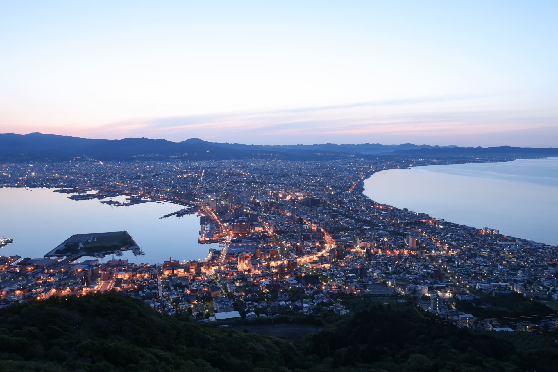
上記写真は「表夜景」と呼ばれ、海に挟まれくびれたような形をしています。
その美しさから世界三大夜景にも選ばれており、「100万ドルの夜景」とも呼ばれています。標高334メートルから見下ろす景色の左側には津軽海峡が、右側には函館湾が広がっており、幻想的なオレンジ色の灯りが広がります。
The above photo is called “Omote Yakei” (front night view), which looks as if it is wedged between two oceans.
Because of its beauty, it has been selected as one of the three most beautiful nightscapes in the world, and is also called the “Million Dollar Nightscape. Looking down from an elevation of 334 meters, you can see the Tsugaru Straits on the left and Hakodate Bay on the right, with fantastic orange lights spreading out.
- Q函館山の「裏夜景」とは?
What is the “back night view” of Mount Hakodate? - A
函館で穴場スポットとして人気なのが「裏夜景」です。「裏夜景」とは、函館山から車で30分ほどの城岱牧場展望台やきじひき高原からみる夜景のことです。
ちょうど函館山の反対方向からの夜景なので、函館山を含む夜景を楽しめます。また、車でも楽しめるためドライブデートにもオススメです。
The “back night view” is popular as a hidden spot in Hakodate. Uraya-kei” refers to the night view from the Jotai Pasture Observatory and Kijihiki Plateau, which are about a 30-minute drive from Mount Hakodate.
Hakodate, so you can enjoy a night view that includes Mount Hakodate. Hakodate. It can also be enjoyed by car, making it a great place for a driving date.
詳細
 函館山  Mt. Hakodate

住所:〒040-0000 北海道函館市函館山
アクセス:
電話番号:0138233105(函館山ロープウェイ)
公式サイト:なし
函館山ロープウェイサイト:https://334.co.jp/
八幡坂 Hachimanzaka
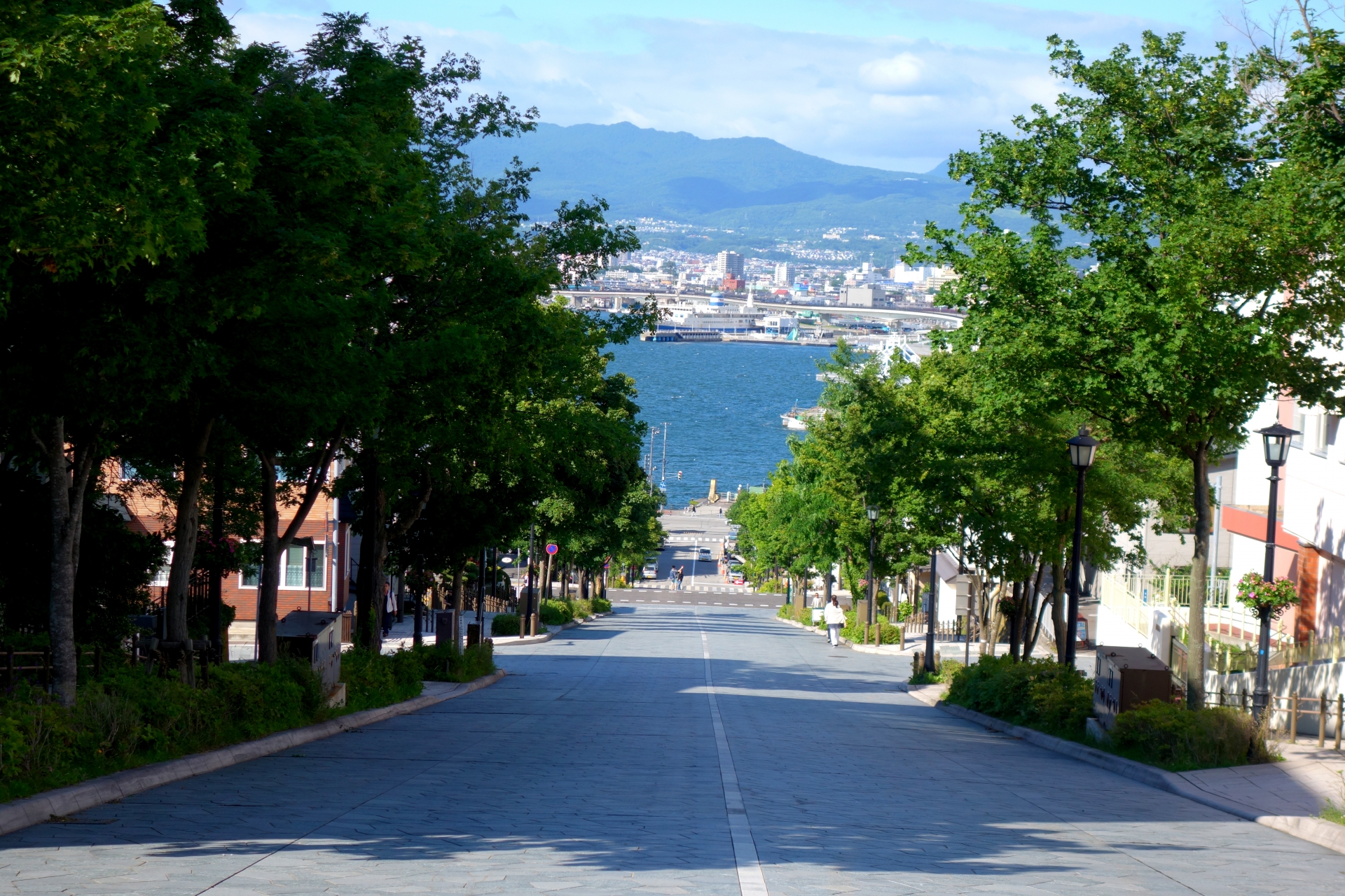
- Q名前の由来は?
Why is it called Hachimanzaka? - A
かつて坂の上にあった函館八幡宮が名の由来となっているそうです。
The name comes from Hakodate Hachiman Shrine, which once stood on the hill.
- Q今も坂の上の八幡宮はあるの?
Is there still a Hachiman Shrine on the hill? - A
大火の被害を受けて1880(明治13)年に現在の谷地頭町に移ったものの、その後も坂の名称は残されました。
Although it was moved to its current location in Yajigashira-cho in 1880 (Meiji 13) after being damaged by a large fire, the name of the hill remained after that.
- Qなぜ有名になったの?
Can we play on this hill? - A
その真下からの眺めが絶景で、かつて、CMで年配の夫婦が手をつなぎながらスキップするシーンのロケ地として評判となり、「チャーミーグリーンの坂」と呼ばれることもあります。
The view from directly below is so spectacular that it once gained a reputation as the location for the scene in a commercial in which an elderly couple skips while holding hands, and is sometimes referred to as “Charmy Green’s Slope.
- Q優しさポイントは?
What are the tenderness points? - A
両歩道脇には、坂上まで手すりつきの階段が整備され、冬には歩道にロードヒーティングが施されています。
Stairs with handrails are provided on the sides of both walkways to the top of the hill, and the walkways are road-heated in winter.
詳細
 八幡坂  Hachiman Zaka

住所:〒040-0054 北海道函館市元町
アクセス:	函館空港から車で約20分
JR函館駅から車で約5分
函館港フェリーターミナルから車で約15分
電話番号:0138-21-3453
公式サイト:https://www.city.hakodate.hokkaido.jp/docs/2022042500230/files/E_10.pdf
大沼国定公園 Onuma National Park
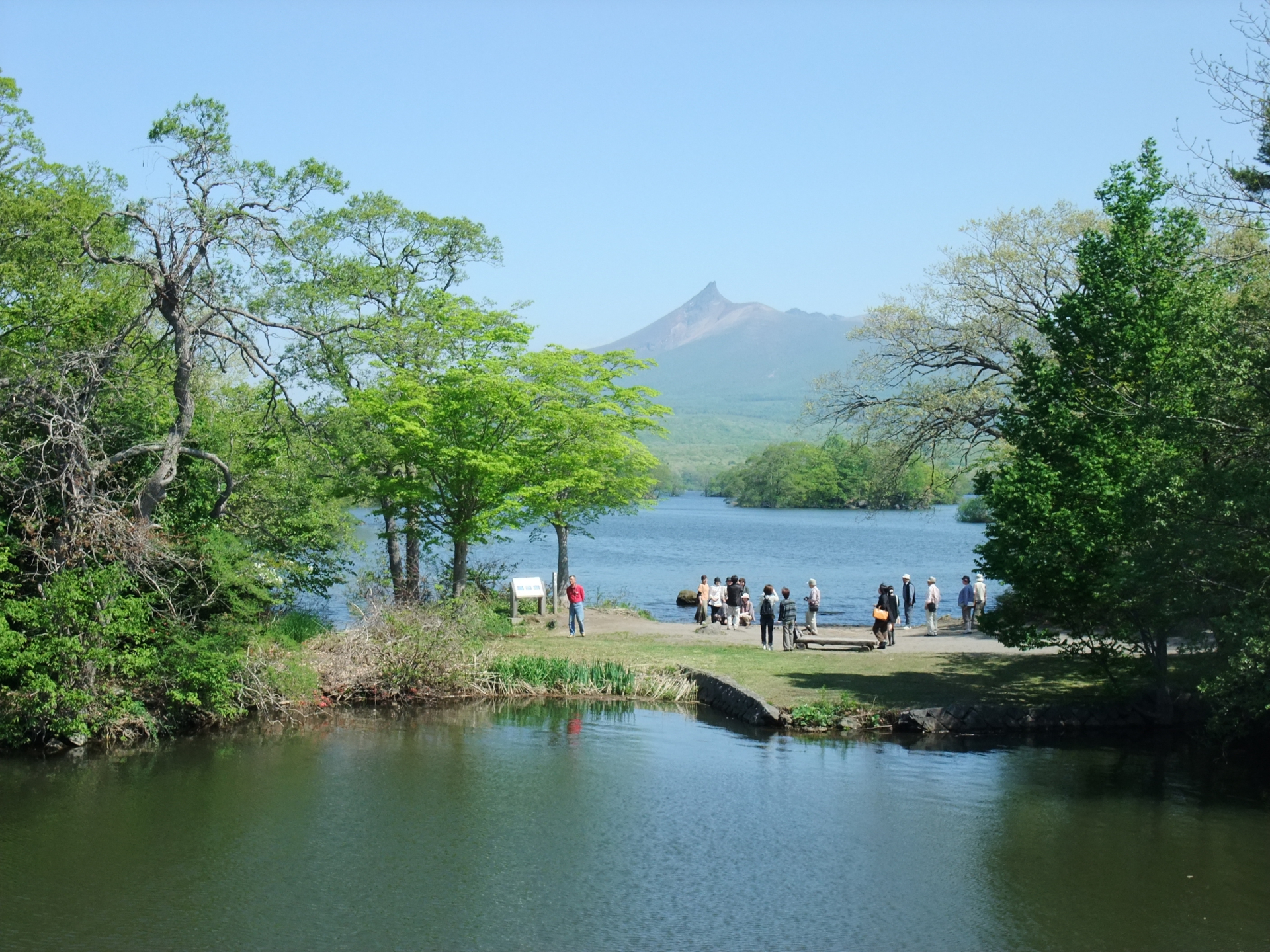
- Q公園の大きさはどのくらい?
How big is the park? - A
総面積は9,083ヘクタール。
Total area is 9,083 hectares.
- Q大沼国定公園にある大沼は沼なの?
Is Onuma in Onuma National Park swamps? - A
大沼は湖です。
湖・沼の定義については明確なものがなく、一般的に中央部への湖岸からの植物の侵入を許さない深度(5~10メートル以上)をもつものが湖とされております。これらの資料等より、大沼は湖と判断しております。Onuma is a lake.
There is no clear definition of a lake or swamp. Generally, a lake is defined as having a depth (5 to 10 meters or more) that does not allow plants to enter from the shore to the center of the lake. Based on these data, Onuma is considered to be a lake.
- Q大沼という地名の由来は?
Why is it called Onuma ? - A
大沼という地名は、アイヌ語の「ポロ・ト」からきています。「ポロ」は「大いなる」を意味し、「ト」は「湖沼」や「水溜まり」を意味します。そこで、「大湖」または「大沼」ということになり、「大沼」がとられました。因みに、小沼は「ポン・ト」から由来しています。
The name “Onuma” comes from the Ainu word “Poro-To. Poro” means ‘great’ and ‘to’ means ‘lake’ or ”pool. The word “polo” means “great” and “to” means “lake” or “pool,” hence the name “Onuma” was taken from it. By the way, “konuma” is derived from “pon-to.
- Q何が楽しめるの?
What can we enjoy there? - A
散策だけではなく、カヌーや遊覧船、釣り、サイクリング、冬はワカサギ釣りなどの盛り沢山。
Not only walking, but also canoeing, sightseeing boats, fishing, cycling, wakasagi fishing in winter, and much more.
詳細
 大沼国定公園  Farm Tomita

住所:〒041-1354 北海道亀田郡七飯町
アクセス:JR 「大沼公園」駅 下車 徒歩5分
入園料:無料
駐車場:
電話番号:0138479439
公式サイト:http://onumakouen.com/
道東エリア(網走、知床、釧路など)
サロマ湖 Lake Saloma
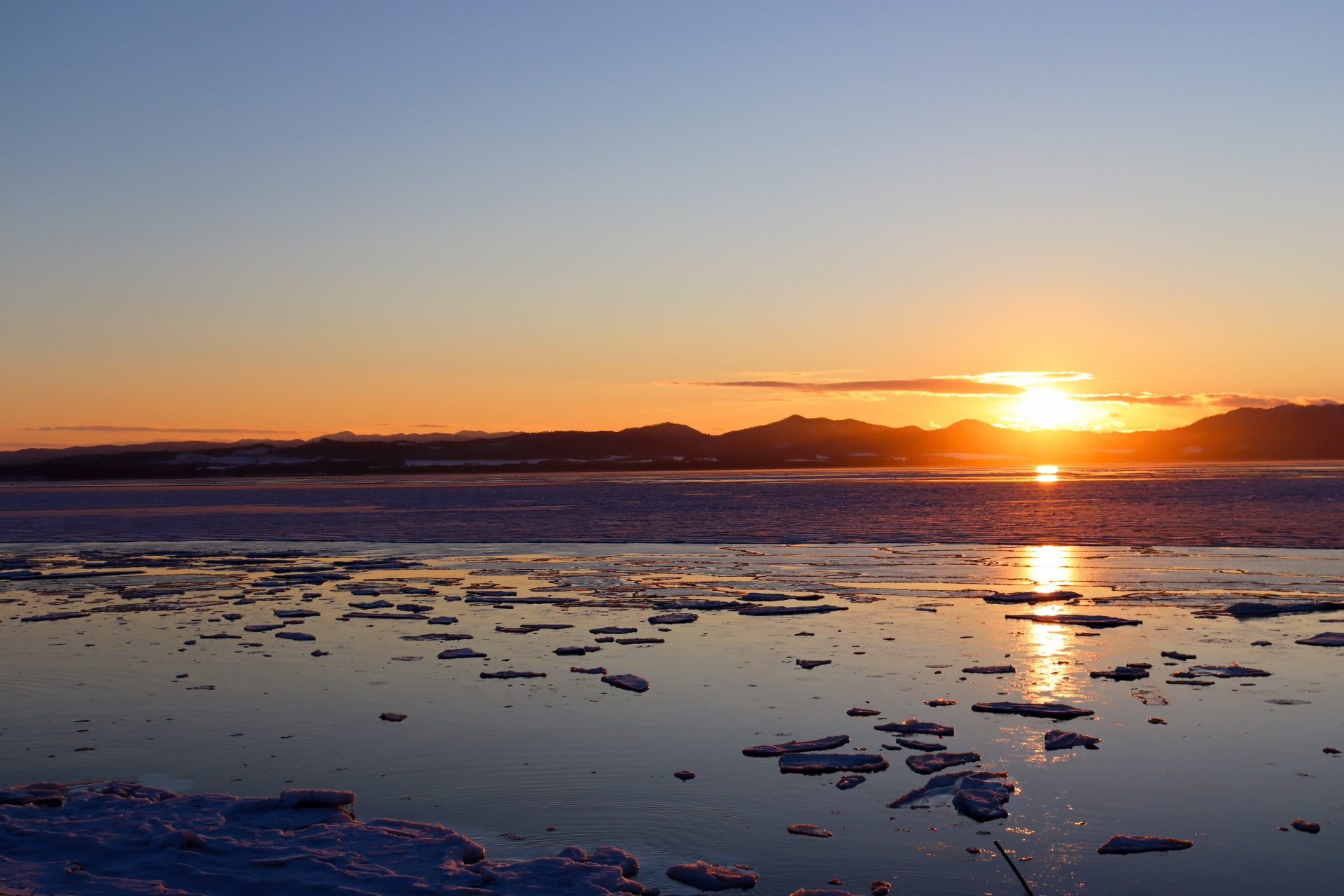
- Qサロマ湖の由来は?
What is the origin of the name Lake Saroma? - A
アイヌ語の「サロ・オマ・ペット(葦のあるところ)」、「サラ・オマ(葦のあると ころの沼)」から「サロマ」となった。
- Qサロマ湖は海水?
Is Lake Saroma seawater? - A
白砂嘴でオホーツク海と隔てられている汽水湖です。
*砂嘴 : 沿岸流により運ばれた漂砂が静水域で堆積して形成される、くちばし形の地形のこと
*汽水湖 : 海水と淡水の中間の塩分を持つ水のことをいい、その水を湛えている湖のこと
It is a brackish lake separated from the Sea of Okhotsk by a sand spit.
- Q日本の湖では何番目に大きいの?
How big is this lake out of all the lakes in Japan? - A
日本で3番目、北海道では1番大きな湖。
ちなみに日本の1番目は琵琶湖、2番目は霞ヶ浦。
It is the third largest lake in Japan and the largest in Hokkaido.
Incidentally, the first in Japan is Lake Biwa and the second is Kasumigaura.
詳細
 サロマ湖  Lake Saloma

住所:北海道北見市常呂町・佐呂間町・湧別町の3町
アクセス:バス JR網走駅からサロマ湖栄浦行きで約60分「ワッカネイチャーセンター入口」下車徒歩約10分
車 女満別空港から国道39号・238号経由で43km約60分・佐呂間町市街地から約20分・道の駅「サロマ湖」から約15分
駐車場:10台 無料
電話番号:0152-54-3434(サロマ湖ワッカネイチャーセンター)
公式サイト:https://www.biei-hokkaido.jp/ja/shirogane-blue-pond
釧路湿原国立公園 Kushiro Marshland National Park
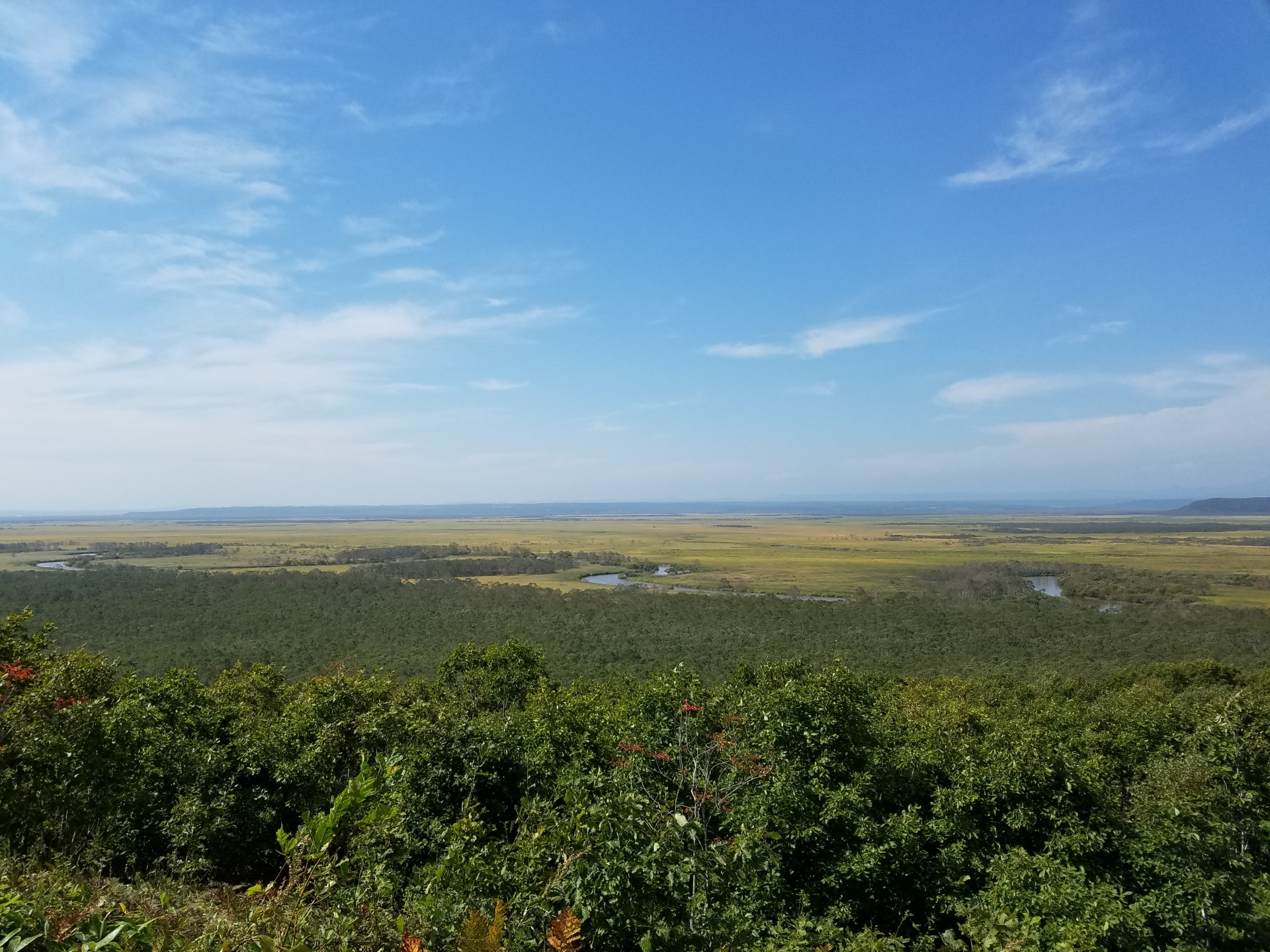
- Q公園の広さは?
When is the best time to see lavender? - A
面積26,861ha(湖沼含む)なんと、東京ドームの約5,635個分。
日本で最も広い湿原。
東西最大幅25km、南北36kmArea 26,861 ha (including lakes and marshes)
The widest marshland in Japan.
The maximum width is 25 km from east to west and 36 km from north to south.
- Q動物は何種類くらい住んでいるの?
How many species of animals live there? - A
動物は哺乳類39種、鳥類約200種、爬虫類5種、両生類4種、魚類38種、昆虫類約1,100種にものぼり、代表的なものではエゾシカやキタキツネ、希少な種では大型猛禽類のオジロワシ、日本最大の淡水魚であるイトウ、エゾカオジロトンボなどがあげられます。
There are 39 species of mammals, about 200 species of birds, 5 species of reptiles, 4 species of amphibians, 38 species of fish, and about 1,100 species of insects. Representative species include the Ezo sika deer and the northern flying fox, and rare species include the white-tailed eagle, a large bird of prey; the itou, the largest freshwater fish in Japan; and the Ezo-kaujiro dragonfly.
- Qタンチョウはいるの?
Are there cranes? - A
います。釧路湿原を代表するタンチョウは、乱獲及び環境の変化により減少し、一時期は絶滅したと考えられた時期もありましたが、その後の様々な保護活動により個体数を回復し、現在は釧路湿原を中心とする北海道東部などで見ることができます。
There is. The red-crowned crane, which represents Kushiro Marsh, has declined due to overhunting and environmental changes, and was once thought to be extinct.
詳細
 釧路湿原国立公園  Kushiro Marshland National Park

住所:2-2101 北斗 釧路市 川上郡 北海道 084-0922
アクセス:釧路湿原駅から徒歩で10分
入園料:無料
電話番号:0154562345
公式サイト:https://www.env.go.jp/park/kushiro/
\北海道に行きたくなった方はこちら/


Comment コメント